Smoke from 2023 forest fires in Canada reaches Norway
At NILU, FLEXPART was used to forecast how the smoke from the Canadian wildfires moved over Greenland and Iceland before it would reach Norway (see video below). The model output was confirmed with observations in southern Norway (Birkenes Observatory) with increasing concentrations of aerosols.
In the affected areas of North America, the concentration of smoke particles in the air could have been harmful to health. Besides this, smoke and soot particles can settle on ice and snow-covered surfaces, making the surface darker, so that it absorbs more solar radiation and contribute to warming the atmosphere. This is an important reason to monitor particles in the atmosphere at observatories all over the world, including Birkenes in Agder, Zeppelin on Svalbard and Trollhaugen in Antarctica.
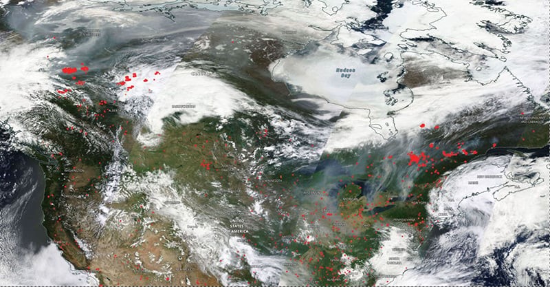
FLEXPART was run with meteorological data from the Global Forecast System (GFS) of the National Centers for Environmental Prediction (NCEP). The injection altitude was variable with a highest value identified at around 4 kilometers up in the air. The location of active fires and their radiative power can be observed by satellite instruments, from example MODIS and VIIRS (see figure below).
The model output could be evaluated with ground based monitoring data. On Wednesday 7 June, smoke particles from Canada were measured at the Birkenes observatory in the south of Norway.
Methodology for Lidar Monitoring of Biomass Burning Smoke in Connection with the Land Cover
Biomass burning (BB) constitutes one of the major sources of aerosols and often represents a major pollution event in the planetary boundary layer (PBL), free troposphere (FT), or even in the stratosphere.
Adam et al., 2022 combined the residence times obtained from FLEXPART version 10 with emissions of black carbon and organic carbon. The contributions of biomass burning emissions from eight types of BB were computed. The main contributors to the BB smoke are: (1) agricultural waste burning, (2) savanna, grassland, and shrubland fires, and (3) temperate forest fires.
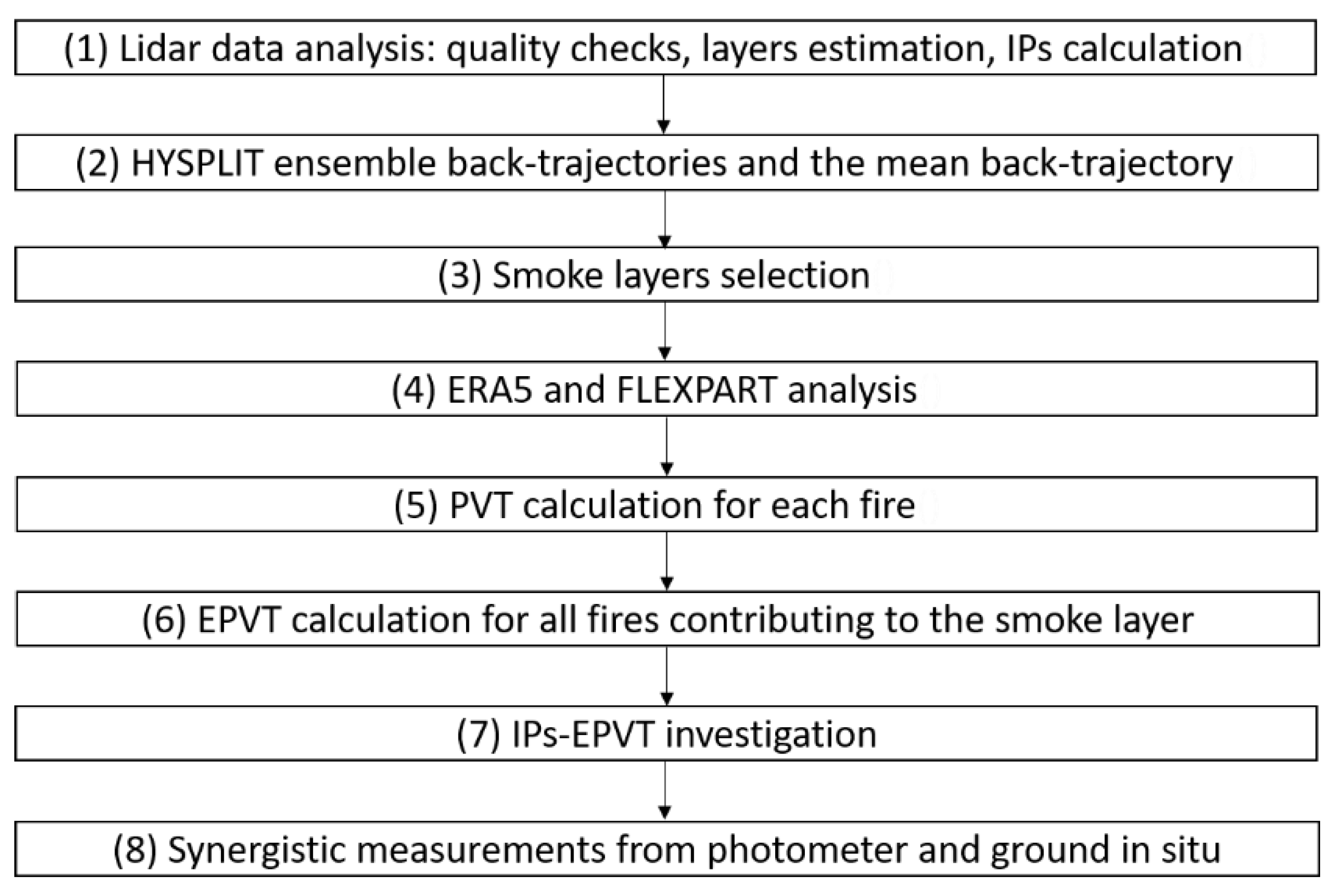
The transport of aerosols (and source–receptor sensitivity—SRS) for each layer identified from lidar measurements was simulated considering all atmospheric processes (e.g., cloud, wet and dry deposition, aging, turbulent diffusion) starting with 10,000 particles tracked for one up to four backward days (24–96 h), with the particle positions being stored every hour.
Eleven smoke layers (from six hourly Raman lidar measurements) recorded at Măgurele, Romania, in 2014, 2016, and 2017 were analyzed. The intensive parameters in the smoke layers were investigated in connection with the effective predominant vegetation type of the burned area. The aerosol pollution layers were labeled as smoke layers if there were fires along the mean back-trajectory and the injection height from those fires was above the air mass trajectory. FLEXPART showed the agricultural waste burning as the main source for all 11 smoke layers.